I-5 flood catastrophe could be national security issue, cutting JBLM from many troops

READ MORE
A Lifeline in Peril
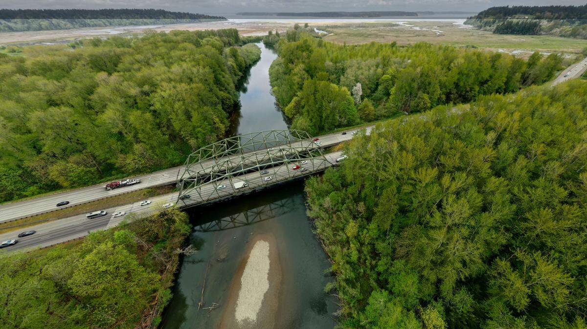
Fill material for piers of a bridge that carries Interstate 5 over the Nisqually River delta act as a dam, altering the course of the river. The construction technique, meant to shave costs 60 years ago is endangering salmon runs and increasing the threat of a flood that could take I-5 out of service, creating a risk not only to the environment but also to national security.
Expand All
They cut costs in the ’60s. Now part of I-5 faces flood danger or up to $4.2B to fix
I-5 flood catastrophe could be national security issue, cutting JBLM from many troops
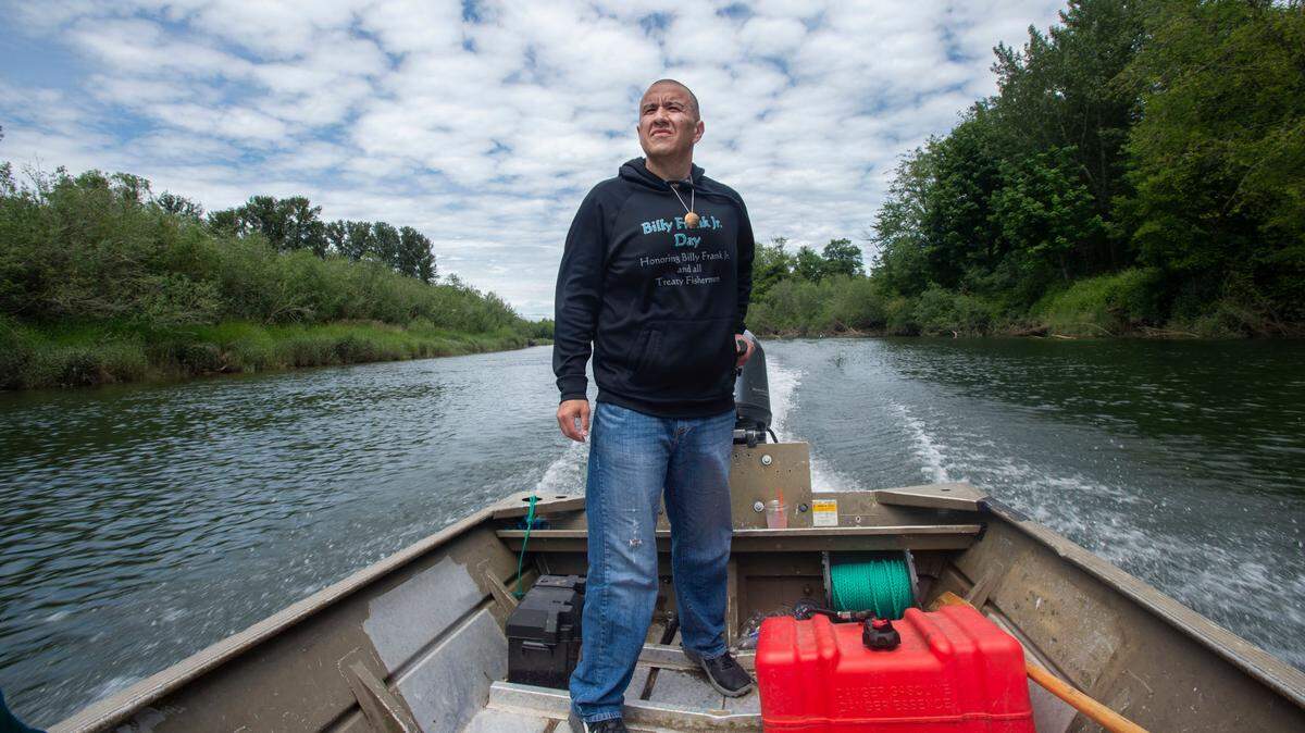
As I-5 chokes the Nisqually, tribe warns circle of life for salmon, orcas collapsing
To correct a 50-year-old mistake, WA must act now to address I-5 flood risk at Nisqually
Rising sea levels and rainier winters are likely to result in floods that could affect Interstate 5 where it crosses the Nisqually River, possibly as soon as 2040. If the river overflows, it could cut Joint Base Lewis-McChord off from more than a third of its workforce, officials say.
The military base is concerned about the impacts a flooding event would have on its operations, former garrison chief of staff Tom Knight told The News Tribune before retiring from the civilian post earlier this year.
Knight estimated about 40 percent of the JBLM workforce lives south of the base, passing over the river to reach the base.
“That particular section of I-5 as it moves through the delta is even more important now because we have to move our population on and off the base daily,” Knight said. “If we don’t address those issues, it is only going to become worse moving forward.”
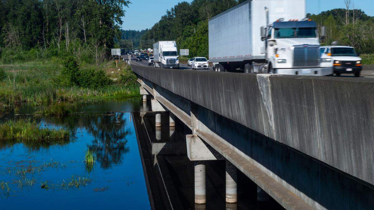
Joint Base Lewis-McChord sits about five miles from Interstate 5’s Nisqually River bridges, which have been acting as a dam to the natural path of the Nisqually River for the last 50 years.
The original bridge once stretched on pilings for more than two miles, allowing the river to flow into Nisqually
Reach through a number of branches. But the pilings were filled in with dirt, rocks and other materials during a 1968 expansion, essentially creating a causeway with just a few breaks for water to flow.
The causeway is changing the course of the river. Combined with the effects of climate change, that is increasing the likelihood of catastrophic flooding in the Nisqually River basin.
State and federal officials, the Nisqually Tribe and the base all agree the clock is ticking. They have begun looking for solutions, which early estimates predict could cost $4.2 billion.
The Nisqually Tribe of Indians and South Sound Military & Communities Partnership have created a preliminary design that would elevate and expand the bridge and remove the fill from a mile on either side of the two bridges that carry I-5 over the river. The excavation would allow for the river to flow more freely to Nisqually Reach.
The discussions and early studies have yet to yield commitments, leaving some worried.
Bill Adamson is a program director for South Sound Military & Communities Partnership. The partnership is a group of more than 50 cities, counties, tribes, nonprofits, corporations, organizations and the base.
It could be dire if soldiers can’t report for work, Adamson said.
“It’s a national security issue, because they can’t do their mission without their workforce,” he told The News Tribune in May.

Marc Daily is Thurston Regional Planning Council’s executive director. Daily echoed Adamson, saying the bridges and their effects are bigger than traffic and salmon recovery.
“If anything happens to that bridge, it would impact their readiness and preparation,” he said of JBLM.
There is no convenient alternative to Interstate 5 in the 17-mile stretch between Olympia and Tacoma, leaving soldiers, civilian workers and Air Force personnel with hours on the road to reach the base during a major flood or crash.
Military officials pointed to the December 2017 Amtrak Derailment in DuPont as proof of the potential repercussions. First responders rescued passengers from the northbound train that derailed off of the railroad bridge at 7:40 a.m. just south of Mounts Road, about a mile from the Nisqually River.

People who use I-5 between Pierce County and were stuck. For three days, people wishing to head south had two options: drive around the Kitsap Peninsula and through Olympia or head through Yelm.
The option across the Kitsap Peninsula was to take state Route 16 west from Tacoma to Route 3 in Port Orchard then south toward Shelton to U.S. 101 and on to Olympia to I-5.
The Yelm option was to take state Route 512 to Route 7 the Route 507 to through Yelm and then into Thurston County using Route 510.
Reverse directions on both detours assuming I-5 north is ever blocked.
During the DuPont derailment, people using those detours experienced up to nine-hour backups, said Doug Adamson, spokesperson for the Washington State Department of Transportation.
The base opened an internal road to alleviate traffic during the derailment, but the two-lane road from Old Pacific Highway Southeast to Center Drive could only take one direction of traffic at a time. At one point during the I-5 closure, it took three to four hours to travel through the JBLM detour, Doug Adamson said.
Officials have said there doesn’t need to be a major accident to see that expansion of Interstate 5’s South Sound stretch needs to occur.
Even during daily commuter hours, the lack of options causes bad traffic.
“We don’t need to wait for a disaster to point out the fact that there’s just not enough capacity on the roadway there,” Knight said.
The Washington State Department of Transportation estimated in a 2020 traffic study on Interstate 5 between Mounts Road and Tumwater that more than 121,000 trips are taken across the Thurston-Pierce border each day. The study noted that there are “several performance issues” with that stretch of the highway, and an average of 20 minutes of congestion for southbound traffic during the evening commute.
The study concluded that further review needed to occur before recommendations could be made.
The congestion is expected to worsen as the military increases the number of soldiers on base by 2,000 by early next year, Bill Adamson said. The base currently holds more than 40,000 active-duty soldiers.
The South Sound Military & Communities Partnership is hoping the Pentagon would help fund a potential $4.2 billion project to rebuild the I-5 bridges to eliminate the causeway.
The Department of Defense has helped cover costs of congestion studies surrounding JBLM. The City of Lakewood received $330,000 to create the 2015 Joint Land Use Study analyzing traffic around the base, and SSMCP is spearheading a Growth Coordination Plan to be completed by March 2022 after receiving a $715,000 grant from the Department of Defense.
A Department of Defense spokesperson, Peter Hughes, said while a project such as the Nisqually River bridges would fall under the $50 million to $60 million grant program “Defense Community Infrastructure Pilot Program,” most awardees’ projects are on a base with support from the surrounding community.
The largest award last year was $10 million to Great Falls, Montana for a project to build a recreation center for military families. Joint Base Lewis-McChord has never received funding from this program, Hughes said.
“There are no assurances nor commitments on likelihood of funding under this program due to its competitiveness,” Hughes said in an email.
Former News Tribune reporter Abbie Shull contributed to this report.
This story was originally published December 1, 2021 at 5:00 AM with the headline "I-5 flood catastrophe could be national security issue, cutting JBLM from many troops."