They cut costs in the ’60s. Now part of I-5 faces flood danger or up to $4.2B to fix

READ MORE
A Lifeline in Peril
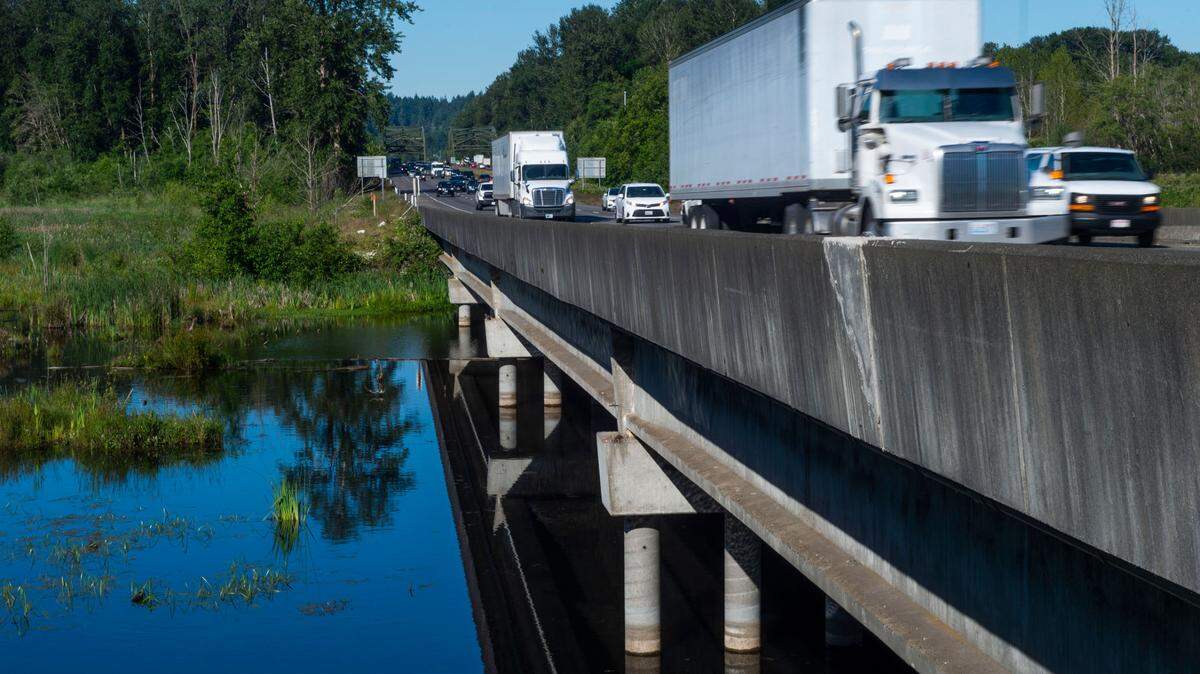
Fill material for piers of a bridge that carries Interstate 5 over the Nisqually River delta act as a dam, altering the course of the river. The construction technique, meant to shave costs 60 years ago is endangering salmon runs and increasing the threat of a flood that could take I-5 out of service, creating a risk not only to the environment but also to national security.
Expand All
They cut costs in the ’60s. Now part of I-5 faces flood danger or up to $4.2B to fix
I-5 flood catastrophe could be national security issue, cutting JBLM from many troops
As I-5 chokes the Nisqually, tribe warns circle of life for salmon, orcas collapsing
To correct a 50-year-old mistake, WA must act now to address I-5 flood risk at Nisqually
A shortcut meant to save Washington state money more than 50 years ago has created a vast ecological problem and a potential transportation nightmare today that could cost billions of dollars to fix.
Fill material meant to protect bridge piers that carry Interstate 5 over the Nisqually River delta between DuPont and Lacey is acting as a dam, altering the course of the river, endangering salmon runs and increasing the threat of a catastrophic flood that could sever the West Coast’s main north-south freeway.
Initial models by the U.S. Geological Survey show such a flood could occur within 20 years.
“The timing and extent that I-5 is likely to become vulnerable to the projected changes in sea-level rise and stream flows were evaluated in terms of water levels that will disrupt access to the highway and potentially cause danger to human safety,” USGS scientist Eric Grossman told The News Tribune in September.
A proposed fix could cost up to $4.2 billion, according to initial estimates by the Nisqually Tribe of Indians and the South Sound Military & Communities Partnership. The tribe has proposed removing the concrete, rocks and dirt underneath Interstate 5 on either side of the bridge to allow the Nisqually River to flow freely under 2.5 miles of the highway.
The threat has officials from the state and the local level, Joint Base Lewis-McChord and the Nisqually Tribe urgently working together to find a solution.
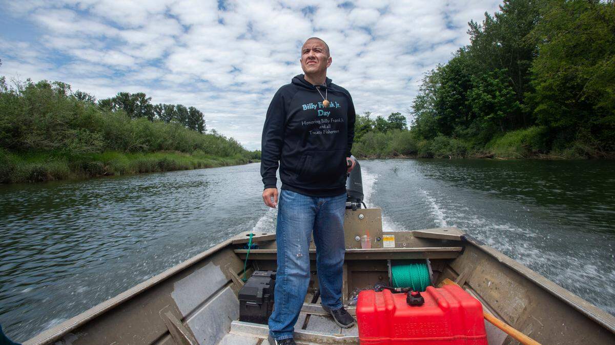
The Nisqually Tribe’s natural resources director, David Troutt, said stakeholders all realize something needs to be done.
“It’s this intersection of salmon and human rights and killer whales and the economy and national security that has really brought the attention of not only that small Indian tribe, but all of our partners in the south region, with the South Sound Military & Communities,” Troutt said.
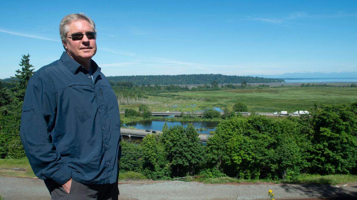
Bill Adamson is the director of South Sound Military & Communities Partnership, a multi-jurisdiction partnership under the City of Lakewood. His organization worked with the tribe to engage local officials and create awareness of the threat. He is worried about the impacts flooding on Interstate 5 could have on the economy and the military base nine miles north of the bridge.
“I-5 is the lifeline of commerce for this South Sound region,” Adamson said.
The partnership and the Nisqually Tribe hope that informing local officials will be enough to prompt support and financial backing.

Thurston County Regional Planning Council director Marc Daily said addressing the bridge problem is the top transportation priority for the council.
“As we have gotten more and more into this, we realize it’s more than just a traffic concern; it’s about the salmon and it’s about the joint base,” Daily said.
Democratic U.S. Rep. Marilyn Strickland (WA-10) represents sections of Thurston and Pierce counties. She agrees with the concerned stakeholders that a safe, sustainable and green rebuild is needed. Strickland supports a solution that engages all stakeholders and plans to work with WSDOT on bridge reconstruction.
“When we think about infrastructure, the U.S., we tend to be reactive instead of proactive. And so, you know, there’s an opportunity here to really think carefully about all the impacts that this could have,” Strickland said.
Asked if she found the problem to be an immediate concern, Strickland told The News Tribune that while she supports it, her hands are tied until the state presents a design and funding plan for the potential project.
“I’m at the point right now to talk about what a funding split would look like, because we don’t even know the price tag of this, or what elements need to be funded,” she said.
The problem
Just south of the base on the border of Pierce and Thurston counties, drivers cross the Nisqually River on Interstate 5. Northbound traffic takes a bridge built in 1938, while southbound traffic takes another bridge a few feet away built in 1968.
A driver passing over the Nisqually River might not see anything to worry about, but reports suggest the bridges act as a chokepoint for the river, which historically flowed as several tributaries seeping into Nisqually Reach.
The bridge built in 1938 was called the longest concrete bridge in the state at the time, stretching 2.75 miles, according to The News Tribune archives. It was elevated on concrete pillars, letting the Nisqually River flow freely underneath. The initial bridge cost $1.7 million to create, or an estimated $32.9 million in today’s dollars.
The second bridge was built in 1968 to reduce crashes on the original bridge, which initially carried both directions of traffic.
The second bridge construction also included fill underneath the highway on either side of both bridges, according to public records obtained from WSDOT. Crews filled in the space underneath most of the bridge with rocks, concrete and dirt and added three lanes for southbound traffic on the new causeway. The construction left about 180 feet for the river, where the second truss bridge was built.
According to newspaper archives, the 1968 construction cost $3.5 million, or the value equivalent of about $27.3 million today. Money was tight for WSDOT at the time. In 1966, The News Tribune wrote that the state Department of Transportation had to borrow money to pay contractors.
Spokesperson for WSDOT, Doug Adamson, told The News Tribune in June 2021 the decision to fill in the space underneath the couple of miles flanking the current river bed was a financial one. It was cheaper for the state to fill in the majority of the existing bridge, rather than replace the concrete piers every few decades, he said.
“To reduce costs, I-5 was put on fill through most of the Nisqually Valley, rather than on piers as originally constructed,” according to a 2020 WSDOT study on the I-5 corridor from Tumwater to Mounts Road.
The state transportation department did not have the same environmental standards in 1968 as now, Adamson said.

He said WSDOT would have started complying with environmental laws in the 1970s after the project was completed. Congress bulked up the National Environmental Policy Act in 1970, the Clean Water Act in 1972 and Endangered Species Act in 1973. Washington enacted the State Environmental Policy Act in 1971.
In public records obtained from WSDOT, there were two 1966 contracts for the second bridge: one for work from the Nisqually River to Old Nisqually Road in Pierce County, the second from Martin Way to the Nisqually River in Thurston County.
The state requested that the causeway be filled with riprap, dirt, rocks and concrete to control for “excessive erosion.”
“Under no circumstance is there to be created a block to stream flow or fish passage,” the 1966 WSDOT contract in Pierce County states.
The contract for Thurston County work directed the contractor to construct a new channel and divert existing stream flow once the channel “has been excavated to the desired width and depth.”
But the fill squeezed the tributary-like Nisqually River to flow into a fraction of its natural path.
Currently, there are four outlets for the river under Interstate 5, none of which are wider than the 180 feet underneath the truss bridges. Other release points include a 36-foot gap of McAllister Creek, a stream off the Billy Frank Jr. Nisqually National Wildlife Refuge, and two smaller breaks book-ending the Nisqually River bridge.
Doug Adamson said WSDOT would not propose to use fill to support Interstate 5 across the estuary today.
“The roadway is structurally and seismically sound, but we now recognize they are not the best structure for the environment,” he said.
Preliminary models from Grossman show the causeway is obstructing the natural path of the river and could lead to catastrophic flooding.
“It’s possible that had I-5 been constructed with a bridge configuration rather than an extensive causeway, flooding would be less,” Grossman said.
Increasing flood danger
Climate change is creating a “new normal” for flooding on the Nisqually River.
Washington climate scientists have said climate change will lead to drier summers and wetter winters. Grossman said there will be more rain than snow in autumn and winter. Without mitigation, runoff draining from the Cascade Range is expected to increase in frequency and intensity by 20 to 50 percent by 2080.
A higher discharge of rainwater runoff from Mount Rainier and, to a lesser extent, higher sea level rises will jeopardize Interstate 5, Grossman said.
The pinch point at the bridge is causing a portion of the current to travel back upstream.
In describing the effect, Troutt said to imagine stepping on the middle of a rope. Then grab the section behind you and begin to wriggle it back and forth. The rope behind your foot begins to form an “S,” while the rope in front of your foot sees no change. Your foot acts as a dam.
The I-5 causeway is acting as your foot does, slowing the Nisqually River as it flows from Mount Rainier. The water builds up and snakes as it approaches the I-5 bridges. That pushes some of the current back, essentially sending the river back the way it came. At the bridges, there are a few hundred feet where the river flows both ways. The Nisqually River also is charting a new path, twisting into sharper corners as the energy builds behind the bridges, Troutt said.
If the river sees a higher-than-normal flow, the only place for water to go is over Interstate 5.
At its lowest, the bridge deck is 6.9 meters high. Grossman said initial models suggest that if a flood that occurred in 1996 were to occur by 2080, the predicted sea levels and rainfall intensity would bring water within a foot of the highway.
“… with sea level rise and the current constriction imposed by the I-5 corridor will lead to water levels over land that will challenge flood management, human safety, transportation and recent investments in ecosystem restoration,” Grossman said.
Grossman is the lead scientist in a study on the vulnerability of the Nisqually River Basin. A USGS report on that vulnerability is expected in the coming months. The state transportation agency’s bridge experts will use the finalized report to determine potential flooding impacts to the highway, Doug Adamson said.
Ecological impact
The altering river course also affects fish migration.
Eighty percent of Puget Sound chinook salmon use the Nisqually Delta to adapt from freshwater to saltwater, Troutt said. They spend months adjusting in the calmer waters near the bridge for their kidneys to slowly acclimate to the difference in salinity. With sea levels encroaching on the river, the salinity of the area has increased.
“It means less time to slowly adapt to becoming ocean animals, which means their survival will drop, and we’re already in a position where our survival is very poor,” Troutt said.
The Nisqually Tribe measures out how many fishing days to allocate to its members by the fish population returning to the Nisqually River. In 1987, the tribe had 105 fishing days, Troutt said. In 2018, fishermen could only fish for eight days.
A drop in fish species also could hurt endangered southern resident killer whales. The Nisqually Delta is the South Puget Sound’s largest producer of chinook salmon, a preferred food for the whales.
Traffic impacts
A flood shutting down Interstate 5 across the Nisqually delta area would be detrimental to the military, commuters and commercial traffic.
“If we lost I-5 to the Nisqually, it would not be pretty,” said Daily of the Thurston County Regional Planning Council.
Officials point to 2017 as evidence for urgency.
A train derailment in DuPont proved how crucial that stretch of I-5 is. On Dec. 18, 2017, an Amtrak Train derailed near the Mounts Road exit between the base and the Nisqually River bridge.
The derailment resulted in a 57-hour closure of all three lanes of southbound I-5, Doug Adamson said.
“Closing any major interstate in the Pacific Northwest can have widespread effects, but the closure in this location was even more detrimental to South Sound traffic because there is no convenient alternate route,” Doug Adamson told The News Tribune in an email about the DuPont derailment.
During the closure, the quickest detour route was state Route 16/state Route 3, even though it was longer in lane miles than the other alternate route.
Drivers who detoured around the closure using state Route 512, state Route 7 and state Route 507 from Lakewood through Roy and Yelm experienced a 14-mile, seven-to nine-hour backup.
“These routes are primarily two-lane roads through rural towns and could not accommodate the amount of traffic that typically travels on southbound I-5,” Doug Adamson said.
Joint Base Lewis-McChord estimates that 40 percent of its workforce lives south of the base. Flooding that would close I-5 has been deemed a national security risk, due to the lack of reasonable alternative routes.
“It’s a national security issue, because they can’t do their mission without their workforce,” Bill Adamson said.
South Sound Military & Communities Partnership and the Nisqually Tribe have taken elected officials on boat trips to show the impacts of Interstate 5 on the river’s path and given presentations to state and federal officials, including the U.S. Department of Transportation. They have requested that legislators prioritize addressing the Nisqually River issue over others because of the significance of that stretch of I-5.
Historical flooding
The area surrounding the Billy Frank Jr. Nisqually National Wildlife Refuge has seen how detrimental impacts of high waters can be.
In February 1996, the Nisqually Delta flooded due to torrential rains, breaking records, according to The News Tribune archives. Waters and mudslides closed Interstate 5 to Oregon near Olympia, and towns off the Nisqually River were evacuated. It took weeks for arterial roads to reopen.

The river rose several feet an hour in the flood, according to archives. Vehicles and homes were washed away. The first floor of many homes on the reservation were underwater, Nisqually Tribal Chairman Willie Frank III recalled.
He worries about facing the same flood levels, but with the increased traffic.
Potential solution
As of August, there have been two studies conducted surrounding the I-5 Nisqually bridges, with a third study approved.
The U.S. Geological Study looked at the current flood conditions, projections and the vulnerability of the lower Nisqually River Delta.
Grossman with USGS said extreme floods are expected to increase significantly. With more intense lowland rainfall projected to increase, larger floods are estimated to surge 125 percent over current levels by the 2040s and 150 percent by the 2080s.
In 2018, a $500,000 WSDOT study reviewed congestion on I-5 from state Route 121 in Tumwater to Mounts Road in Pierce County.
The department determined there would be a significant bottleneck occurring by 2040 just north of the bridges on Interstate 5 at Mounts Road, but recognized that there are bigger concerns.
“The biggest potential factor is the unknown risk to I-5 from the migration of the Nisqually River’s channel just upstream of the bridges,” the WSDOT study said.
The state’s congestion study said if work is required for environmental reasons, it should also allow for future widening to alleviate the anticipated southbound chokepoint at Mounts Road.
The USGS and WSDOT studies were funded by $2 million raised from partnerships with South Sound Military & Communities Partnership and $500,000 from the state.
The 2021 Legislature approved $5 million for a third study, in which WSDOT will review potential solutions to the bridge.
The study will “conduct preliminary engineering to develop alternatives and complete NEPA [ National Environmental Policy Act] review for a proposal to provide congestion relief on Interstate 5 between Tumwater and Mounts Road and restore the Nisqually River delta at the existing freeway crossing,” according to WSDOT’s Doug Adamson.
Statehouse Rep. Andrew Barkis, a Republican who represents the 2nd Legislative District, sponsored the bill to fund the studies.
“The tribe and South Sound Military and Communities Partnership brought this to everyone’s attention that the river is changing course and it could be catastrophic on the highway,” Barkis said.
The state is also working on a “Planned Environmental Linkages (PEL) Study,” which will use the outcome of both previous studies to move forward with the environmental process, WSDOT said.
“Once we conclude, we’ll transition into the work directed by the Washington state Legislature,” Doug Adamson said. “This is expected to begin this winter.”
In 2011, WSDOT published a Climate Change - Adapting and Preparing report. The report recognized that there will be climate impacts on the Nisqually River area by 2050, but WSDOT labeled the risk as low vulnerability.
“The major highway that runs through this area is I-5, which is raised enough that it is not affected by flooding except in a few instances,” the 2011 report said. “The McAllister Creek occasionally floods the on- and off-ramps, and this would be made worse by sea level rise.”
Doug Adamson said the transportation agency recognizes that restoring the estuary is important, but the cost to modify Interstate 5 requires legislative action. Asked about the urgency of the project, he said, “Widening I-5 from Mounts road through Tumwater to increase capacity, including the section across the estuary, is identified as a long-term strategy in our study.”
The Nisqually Tribe and SSMCP have proposed a potential solution: remove the fill and elevate the bridge. They estimate that reinforcing the existing concrete pillars from 1938 to meet current standards and excavating 2.5 miles of fill would cost $4.2 billion.

“We’re hopeful that we can do a complete reconstruction of I-5 across in the Nisqually Delta to protect it for the economic value and value for national security, but do it in a way that also promotes critical habitat for salmon, and is respectful of the tribes treaty rights and desire to fish,” Troutt said.
The group’s proposed solution also would replace the bridges across the Nisqually River and elevate the highway across the refuge. The proposal also looks to widen Interstate 5 from three lanes to up to five lanes each way, and expand the railroad overpasses east of the bridge.
The $4.2 billion price tag would be one of the most expensive projects in Washington. By comparison, a multi-year project to replace the state Route 99 tunnel in Seattle cost upwards of $3.35 billion.
If the primary plan moves forward, there would be impact to some of the arterial roads and business south of the bridge near McAllister Creek, like Medicine Creek Cafe and Nisqually Bar and Grill, Bill Adamson said. Troutt confirmed that but said the tribe is open to working with property owners.
“We would work around these properties to maximize ecological function as soon as possible with the possibility of expansion into some of these other areas over time,” Troutt said in an email.
The group’s ideal timeline would start construction by 2027 and end in 2035. But, they must rely on support from elected officials to push for funding.
Barkis said state funding is dependent on the results of the USGS study when it is officially published, and will likely require multiple sources of money. He hopes that with all the stakeholders on board, the process toward full funding would be reached quickly.
“I think time is of the essence, and I believe that because of the work that’s being done and because we were able to protect funding and get things in motion, we’re not losing time when it comes to advancing this project,” Barkis said. “If things come together, and we get all the data and the funding, I think this is something that could be in the near future.”
The federal government will get more involved once a plan and process is in place to help fund what is needed, Strickland said.
“If you look at large projects that take place, whether it’s mass transit or large highway projects, the federal government always has a role,” she said. “But I’m not at liberty right now to tell you what the allocation would be because we don’t even know the price tag, the phases or the plan.”
This story was originally published December 1, 2021 at 5:00 AM with the headline "They cut costs in the ’60s. Now part of I-5 faces flood danger or up to $4.2B to fix."